
Photo Courtesy National Forest Foundation
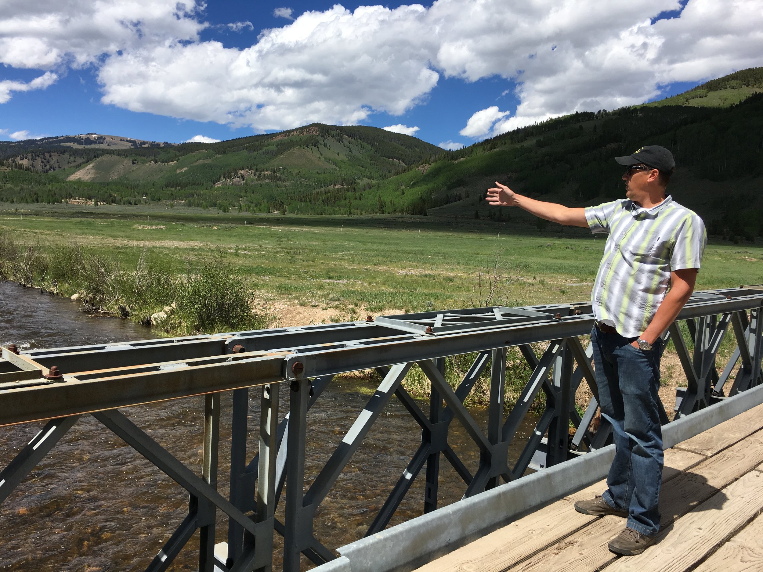
Photo Courtesy National Forest Foundation
National Forest Foundation Camp Hale Eagle River Headwaters Restoration Project 2014
(Healthy Rivers Fund $20,000)
In 1942, the Eagle River headwaters and 240,000 surrounding acres became a warfare training camp for over 17,000 World War II solders, known as Camp Hale. The camp was deactivated in 1964 and returned to the U.S. Forest Service for management. When Camp Hale was established, the large wetlands meadow complex surrounding the Eagle River was drained. 200,000 cubic yards of soil fill was imported to channelize the meandering East and South Forks of the Eagle River headwaters into a three-mile linear ditch. These activities left the river channel much steeper and 40 percent shorter than its natural course. Today, the Eagle River headwaters are essentially “disconnected” from their natural floodplain.
The National Forest Foundation (NFF) is restoring the site through a five-year, multi-stakeholder conservation campaign. The project has brought together stakeholders and interested parties to collaboratively develop a shared vision for future improvements to the site. Colorado Healthy Rivers Fund grant funding was awarded to support the group in the facilitation of stakeholder meetings, facilitation of working group meetings, hosting stakeholder field trips, and the development of a project master plan.
Following the second stakeholder meeting in March 2014, the group began to develop the project master plan document, which is now complete. The master plan incorporated vast stakeholder involvement and has outlined long-term planning, which will be used to carry out Phase II of the project. Phase II will establish partnerships with local nonprofits, contractors, and the U.S. Forest Service to implement science-based ecological restoration activities, while honoring the area’s history and promoting sustainable use of the resources.
Fountain Creek - Manitou Springs
Shryver Park Reach and Pond Restoration Project, 2009
(HRF $50,000)
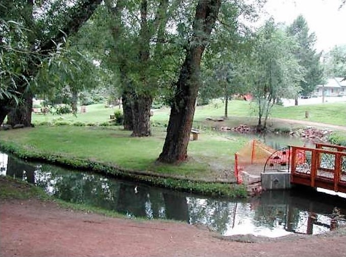
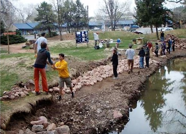
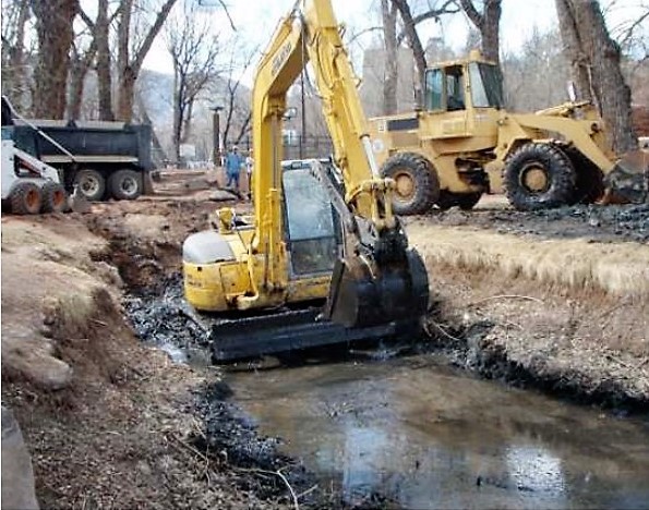
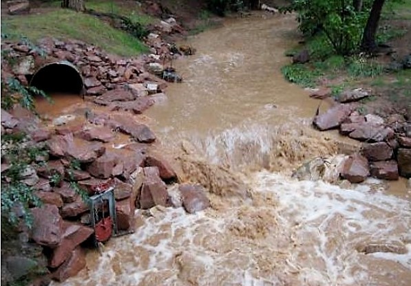
Photo Credit Fountain Creek Restoration Committee & the Pikes Peak Community Foundation
Fountain Creek, within the City of Manitou Springs, had been dramatically altered throughout much of its length through channelization, construction of concrete retaining walls, and urban encroachment within the active floodplain. The community was interested in restoring Fountain Creek and improving the fishery from “Arch to Arch” within the city limits of Manitou Springs.
Shryver Park, adjacent to the Manitou Springs Aquatics Center, is the only pond within Manitou Springs city limits. A detailed aquatic assessment of the Shryver Park stream reach and pond was conducted in May 2008. The assessment indicated that the project reach exhibited generally poor quality aquatic habitat. Sedimentation from local erosion sources, as well as from sources upstream, were negatively impacting aquatic habitat within the reach. The Healthy Rivers Fund was used to support restoration in this reach.
The Fountain Creek Restoration Committee and Pikes Peak Community Foundation reached out to many organizations to make this project a success. The Rocky Mountain Field Institute, Trout Unlimited, Fin-Up Habitat Consultants, the City of Manitou Springs and more worked cooperatively to complete the project. Actively eroding stream banks throughout the project reach were treated and re-vegetated, flood plain function was improved and in channel object cover and pool habitat for resident trout was dramatically increased.
The vision for the Fountain Creek watershed is a strong, resilient, and sustainable ecosystem that supports a variety of interests and activities. This includes a waterway that supports fish and other aquatic species, is safe for recreation, and protects public health where they expect residents and visitors alike to engage in biking, hunting, cycling, fishing, birding, cross-country skiing, camping, and other activities that foster healthy lifestyles and a greater quality of life.
Lake Fork Watershed Working Group
Wetland Remediation of Acid Mine Drainage in the Sugarloaf Wetlands 2008
(HRF $15,000)
Photo Credit Lakefork Watershed Working Group, Lakefork Watershed Plan, 2011
The Sugarloaf Wetlands covers a total of 13 acres, while three acres of the northeast section are classified as a fen wetland. The wetlands are located approximately five miles west of the town of Leadville, CO, and is 450 feet downstream from the Dinero Mine Tunnel. The wetland complex is fed by the intermittent flow from Sugarloaf and Little Sugarloaf Gulches, ephemeral flow from the Dinero Mine Tunnel, and groundwater from numerous springs. The wetlands discharge water into the Lake Fork watershed, of the Arkansas River, through a surface water channel and groundwater seeps.
Chemical characterization of both the soil and water of the wetlands show that Acid Mine Drainage (AMD) and Acid Rock Drainage (ARD) affect the Sugarloaf Wetlands through metal input concentrated in the upper humus soil layer, particularly in the flow direction from the Dinero Tunnel to the Lake Fork. Colorado Healthy Rivers Fund grant funding was allocated to support remediation projects within the watershed that supply the Sugarloaf Wetlands. These projects included relocation and revegetation of three mine waste piles, installation of detention ponds, and installation of a bulkhead (or mine seal) in the Dinero Tunnel.
Historically, two Dinero Mine waste piles were located within a wetland area at the convergence of Sugarloaf and Little Sugarloaf Gulches. These two piles were relocated to on-site engineered repositories. Several limestone-lined settling ponds were installed below the Dinero Tunnel in the footprints left by the relocated mine waste piles to assist in the neutralization of AMD from the Dinero Tunnel and to detain the precipitant. The ponds continue to assist in neutralizing acidic AMD from Sugarloaf Gulch and the Dinero Tunnel. The Dinero bulkhead was installed to reduce the flow of AMD from the Dinero Tunnel, which improves water quality that is discharged to the Sugarloaf Wetlands and the Lake Fork watershed.